
Meet Nour Salam, GISP, Senior GIS Analyst for JMT Technology Group!
Let’s get to know Nour Salam, GISP, Senior GIS Analyst for JMT Technology Group!
Nour has experience using Esri’s desktop and cloud software suite, including ArcGIS Pro, ArcGIS Online, and ArcGIS Enterprise with SDE and is regularly staying in touch with software functionality changes and trends. She is highly skilled in understanding and gathering field data collection requirements and configuring solutions using Esri’s mobile suite of applications (Field Maps & Survey123) to meet business goals. Nour is also locally involved in the Kentucky Association of Mapping Professionals.

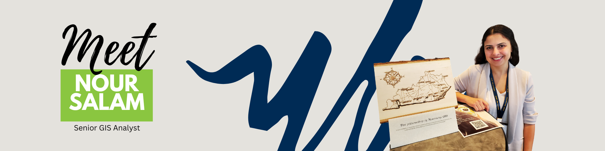
When she’s not busy with GIS, Nour is an avid birdwatcher who is always craving the outdoors, the next road trip, or the next cool bird sighting. So far, she has seen 323 bird species in five different countries, with the latest “lifer” being a beautiful migratory bird called the Cape May Warbler. When she’s spending time indoors, she happens to enjoy - you’ll never guess it – making maps! The art of handmade maps through pyrography is fascinating to her. This hobby began a couple of years ago, and she is always on the lookout for a new map to inspire her next creation.
Nour is also an active member of the Frankfort Audubon Society and served as the president for one year. The Frankfort Audubon Society is a chapter of the National Audubon Society and is dedicated to connecting people with nature through birding education and conservation in and around Frankfort, KY.
Read below to learn more about Nour!
1. What do you do at JMT?
I am a certified senior GIS analyst for JMT Technology Group in Lexington, Kentucky, with seven years of experience. I implement GIS solutions for our federal, state, local, and tribal government clients. I work closely with other analysts, project managers, and client engagement directors to deliver the best solutions.
2. What brought you to JMT?
The first thing that immediately drew me to JMT was the GIS team. I had the opportunity to connect with JMT Technology Group team members at a conference and was immediately impressed by their technical skill showcase in one of the sessions, as well as by how welcoming and approachable they were. Once I met them and discovered JMT, I knew it was a place where I would grow, not only because I would be learning from a great team, but also because I would be joining an employee-owned company.
3. What do you like most about JMT?
At JMT, I do meaningful work, work with a great team, and support a diverse set of clients and projects. This year, using GIS, I supported a project aimed at assisting private landowners with Hurricane Helene recovery in North Carolina. This project was highly rewarding, as it directly and positively impacted people's day-to-day lives. I thrive in the collaborative culture at JMT, always learning from the many disciplines and clients I interact with and support through GIS.
4. What type of projects do you like to work on most?
I like working on challenging and collaborative projects that push my skills and knowledge to the next level, and that make meaningful contributions to our communities. Whether it’s adopting a new ESRI Survey123 trick or learning about how a local water utility system functions from a JMT colleague, I am always learning and growing!
5. What advice do you have for someone who wants to get into this industry / career?
In GIS, communication skills are crucial. My advice for current GIS students is to focus on securing summer internships to primarily enhance the necessary soft skills to succeed as a GIS analyst. I spend half of my time engaging with technical teams or clients, listening to and understanding their needs, and then presenting relevant solutions or ideas before ever beginning technical implementation. These types of effective exchanges are what drive success as a GIS analyst, often more so than technical skills. On the other hand, my advice for anyone looking to make a career change into this industry is to take the necessary online GIS technical training and showcase their interactive map or app skills with an online portfolio. ESRI technical certifications can be helpful as an entry point to validate certain skills, whereas GISP certifications are much more recommended after gaining a few years of experience. I entered the GIS industry as a career change, and it is still one of the best decisions I’ve made. Overall, I highly recommend that anyone join their local GIS professional group or association and attend the local conferences. It is the best way to network and find a job opportunity.
6. What is something new and exciting that you're working on?
I’m currently expanding my skillset in asset management software integrations with ESRI GIS software. For example, I am expanding capabilities for one of our clients using ArcGIS Online and Trimble Cityworks to manage their work orders. I’m also very excited to be supporting a local university in building its GIS program from the ground up, which will involve mapping all its assets, creating a centralized GIS database, and creating effective dashboards and visualizations.
