Highway Network Data Application
Ohio Department of Transportation
Markets utiltized:
Keywords
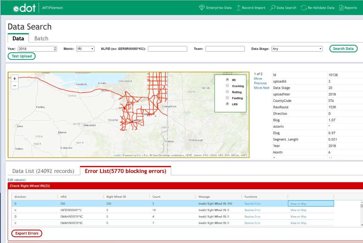
The Ohio Department of Transportation (ODOT) collects and processes pavement condition data (rutting, cracking, faulting and roughness) on a subsection of its roadway network each inspection cycle. Approximately 350,000 records are collected annually using Pathway Services’ PathRunner vehicle and PathView software, and the data must be further processed to align with federal reporting requirements. Historically, data processing required months of time, using a combination of disparate systems and manual methods. ODOT requested an application to replace outdated methods with interactive, automated data processing that would streamline workflows, meet MAP-21/FAST (Fixing America’s Surface Transportation) Act performance reporting requirements, and generate files for both ODOT’s Enterprise Data Warehouse and annual Highway Performance Monitoring System (HPMS) submittal.
JMT developed ODOT’s Highway Network Data Application (HNDA) to import pavement condition data from Pathway Services’ PathView software and interactively process the data using a series of incremental data validation and logical consistency tests. The system imports batch files, flags potential areas of concern in the data, validates the data, and generates reports. ODOT can now more efficiently process pavement condition data, identify and resolve issues much more effectively, and report the best available pavement condition data for a particular roadway.