Vision Zero Dashboard
Anne Arundel County
Markets utiltized:
Keywords
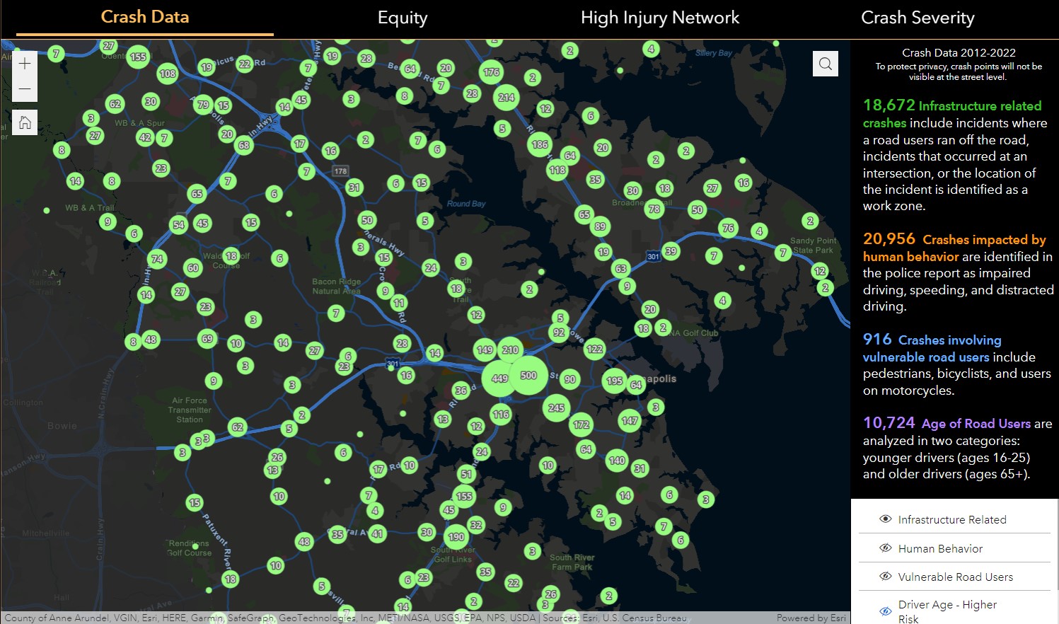
In support of Anne Arundel County’s strategic highway safety program and Vision Zero goal of zero deaths by 2040, JMT assisted the County to conduct a comprehensive review of crash data, crash analysis procedures, strategic plans and guidelines, and recommendations. We developed a Vision Zero dashboard using one of Esri’s newer products, ArcGIS Experience Builder. Applying a decade of crash data provided by Maryland State Police, the user can quickly visualize crash risk areas. As new data are generated, the map layers will reflect the changes, reducing maintenance. The application was configured for the public and for County employees. Users can identify equity emphasis areas and vulnerable citizens by visualizing socio-economic data, as well as high pedestrian and bicycle areas. The database also includes roadway assets that can be visualized along with the crash data to determine where guardrail, roadway lighting, or pedestrian infrastructure may be needed.
This project won the 2023 County Engineers Association of Maryland (CEAM) Small Project of the Year.