Pavement Technology Solutions
Putting your pavement data program on the right path
Pavement Network Definition & Technologies: JMT Technology Group regularly prepares network-level GIS datasets for use by pavement data collection vehicles, taking into consideration the need for alignment with the pavement management system that will ultimately be used to store and analyze the data. We have experience with PathView, PAVER, Lucity, Hansen, and StreetSaver.
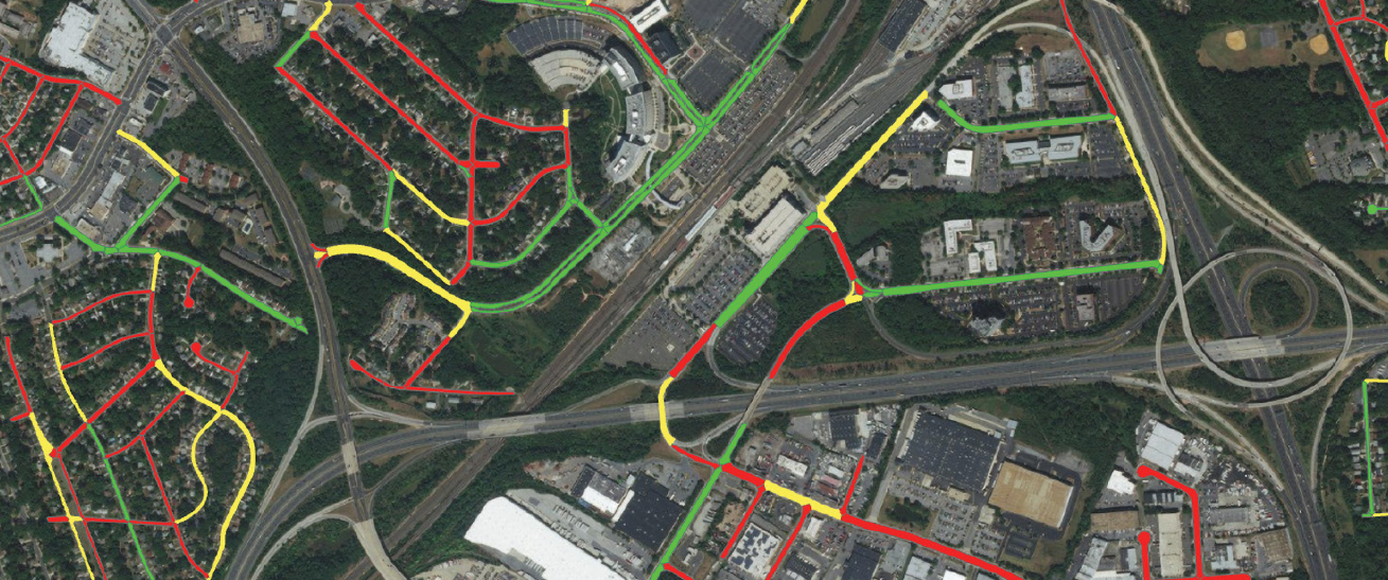
Mapping & Routing: Dynamic maps play an important role in planning and reviewing work to ensure all data has been collected. JMT Technology Group has optimized the process for the collection of data through an automated data collection system. By considering street configuration, surface materials, and order of segment collection, JMT Technology Group can develop the best travel route to get your data collected accurately and efficiently.
Pavement Condition Survey Support: Accurate and reliable pavement condition data presented on both a project-level and network-level are critical components of a pavement management system. JMT Technology Group works closely with customers to ensure that the data collected reflects the documented rating protocols for distress types, rating methods, reporting intervals, and methods to compute condition values.
Pavement Management System Implementation: JMT Technology Group has implemented pavement management systems that integrate data from a pavement management system, with a custom web application, and an ArcGIS Pro solution for managing and analyzing pavement condition data and formulating roadway improvement projects.
Pavement Data Collection: JMT Technology Group has experience with pavement condition data that has been collected through automated and manual methods. We regularly prepare GIS datasets for use by pavement data collection vehicles, taking into consideration the need for alignment with the pavement management system that will be ultimately used to store and analyze the data. Additionally, JMT Technology Group has prepared data for manual collection using Esri’s ArcGIS Online and its configurable application for ArcGIS. This facilitates viewing and editing of pavement GIS, photos, and condition data by office and field personnel.
Custom Tool & Application Development: JMT Technology Group has developed and implemented pavement management applications that include fully customized web-based solutions, desktop solutions, as well as customized COTS solutions. Built to specific user requirements, these systems packages support the collection, analysis, and processing of detailed pavement condition data and deliver it to end users in meaningful formats to support day-to-day workflows. JMT Technology Group has also developed pavement management tools that support the creation, validation, and quality control of pavement data. These applications include distress visualization tools, project formulation tools, and skid testing request tools.
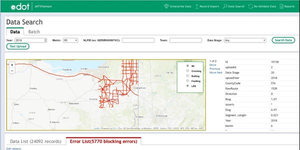
Pavement Data Processing: JMT Technology Group developed a web-based system to process data collected using Pathway Services PathView software to identify issues with spatial reconciliation, data gaps, and other data anomalies. The system flags potential areas of concern in the data and allows users to resolve the issues either by returning to PathView or by resolving the issues directly. In addition, the system will export files for federal Highway Performance Monitoring System (HPMS) reporting and allows the perpetuation of previous years' data to fill gaps in reporting.
Reporting & Dashboards: JMT has developed web-based dashboards to visually track, analyze, and display key performance information related to maintenance and improvement activities by connecting multiple spatial and non-spatial data sources behind the scenes.
Interested in learning more about the path to a better pavement data program? Contact us!